This first part of the route follows an old railway line (climb up to the old railway line from the current railway station rather than going along the road). A short distance along this abandoned line, there was a low metal bar across the path to prevent motorised vehicles. Possibly inspired by the Olympic gymnasts that I had been watching the night before I attempted to jump across it. The result was I went flying, causing a nearby man to ask if I was OK. Apart from a graze on my leg, only my pride was hurt.
The old railway line took me into Penallta Country park, once a coal mining site and now a pleasant, area of lakes, birch & beech trees and dog walkers. On leaving the park, the route turns south across the main road into fields. After some pylons the Ordnance survey map said to turn right along the field boundary, which I did but failed to find an exit out if the field. The owner of the field drove up and ask me what I was doing. On explaining she pointed out the correct exit onto a farm track, which was waymarked but not quite as marked on the map. The gps trail in the link below shows the correct route.
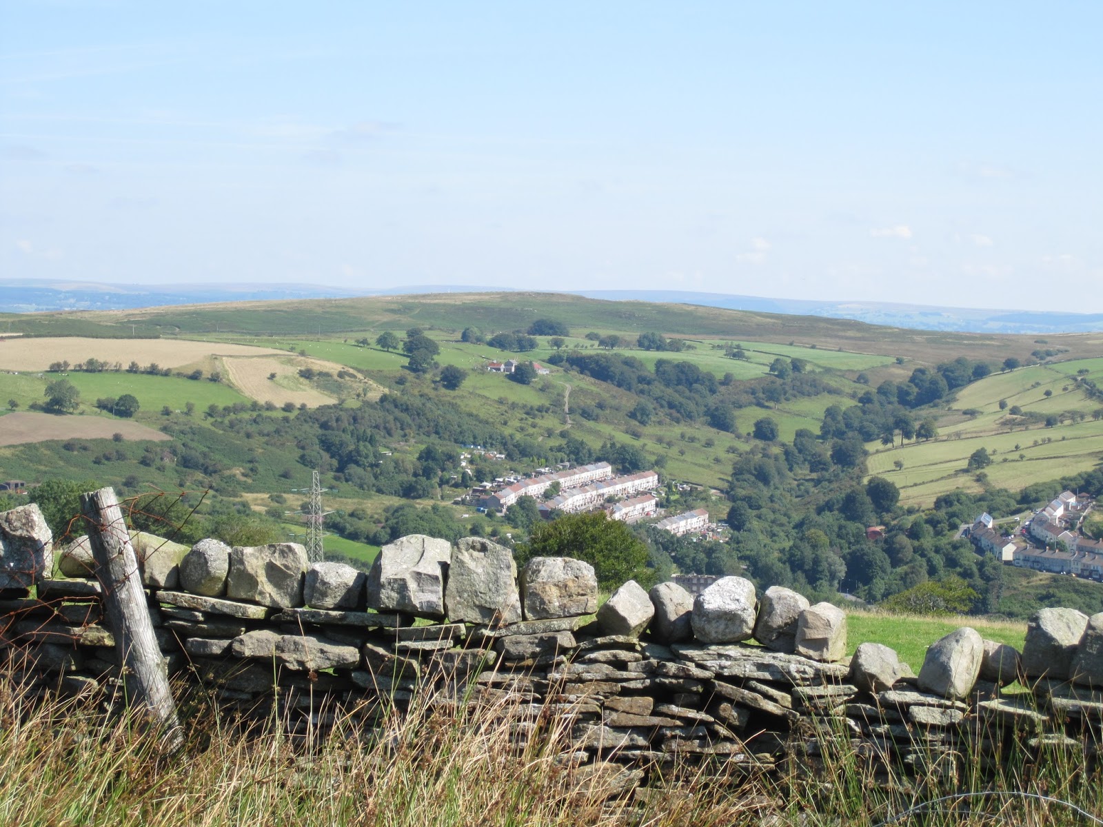
 |
| Entrance to Penallta Country park, following path of abandoned railway |
After walking along some narrow roads (passed an attractive looking Inn) the path rose onto moorland. This area of South Wales typically consists of houses (often terraced) in the valleys, farmland on the lower slopes of the hills and moorland on the top of the ridges. In places (especially steeper slopes) trees replace the farm and moorland. There were Welsh ponies and their foals among the bracken and rushes, they seemed undecided whether to back away from me or follow me. As I walked I scattered small birds from the undergrowth and overhead some bird of prey was gliding in lazy loops over the sunny hillside.
 |
| Typical South Wales country side, terraced houses, farmland and moors |
A section of road followed with an old church (open so you could have a look inside unlike many these days) with gravestones dating from the 19th centuary. Then it was another section of moor around Mynydd Meio. When I last walked this section, I had to give up due to impassable mud, fortunately it was now August and the mud had largely dried up apart from a short section with convenient pieces of wood to balance on as you crossed more squidgy ground.
Approaching the outskirts of Caerphilly (passed another good looking pub) I was told off for walking on a private drive. There were no signs to indicate it was private, waymarking was ambiguous and a stile had disappeared apart from two stumps, so where I was meant to cross looked like a fence laced with electric fence wire. Two separate people admonished me so I headed over the fence and in the (correct) direction they pointed out. On the map the path then appears to follow the main road, but in reality a section of older road beside it made for a leafy stroll up towards the hill of Twyn Garwa. While August is kind to the walker in drying out pools of mud, it is less kind in that brambles are at their most extensive, and the path I took around the hill, which I believe is the correct one, meant pushing through bracken and brambles that pulled at my clothes (long trousers are a help here as well as avoiding the potential embarrassment of looking like a middle aged man in shorts). An alternative route closer to the summit of the Twyn Garwa, following a path used by horses, would have been less damaging.
 |
| Moorland with horses |
I had promised myself some refreshment for all my efforts so I diverted to the "Mountain Snack bar" for a well earned ice cream. This also rewards you with some excellent views across the River Severn. Then I retraced my steps to the official path which after a pleasant walk through trees crosses a golf course. Golf courses always cause some difficulties when public footpaths cross them. There is a risk of having red faced men shouting "fore" at you on crossing the greens and I often find it unclear where I am actually meant to go. This golf course is better than many with a few waymarks, but a few more would be useful as I cannot be sure I followed the correct routing.
After crossing the main road, there is a final section of ridge and an old limestone quarry, before it was time to head down the ridge to Cefn-Onn park and beyond that the Lisvane and Thornhill railways station (on station serving two suburbs). On the way to Cefn-Onn look out for the ventilation shafts, used to help dig the railway tunnel under the ridge to Caerphilly.
 |
| Ventilation shaft above railways tunnel |
In all the path was 27 kilometres long and a good days walk with a total ascent of 637m. The gps trail of the route can be found here.
No comments:
Post a Comment